On 21st June 2024, I set off hoping to run/hike the “Walkers Haute Route”. It didn’t exactly go to plan. Days one and two went without any real issue, but I was finding snow at around 2500m. The route crosses the grain of the Swiss mountains, with 7 passes close to 3000m and a significant time above 2500m. There are no real alternatives as the valley routes would be huge detours. I had to reroute from day 4, heading back for the classic Tour of Mont Blanc (TMB) route. Although I failed to complete the Walkers Haute Route and arrive in Zermatt, I had an incredible experience doing so.
Planned route:
| Day | Start | End | km (mi) | climb (m) |
|---|---|---|---|---|
| 1 | Chamonix | Trient | 24 (15) | 1300 |
| 2 | Trient | Le Châble | 30.5 (19) | 1590 |
| 3 | Le Châble | Cabane de Louvie | 19 (12) | 2060 |
| 4 | Cabane de Louvie | La gouille lac bleu | 34 (21.3) | 1850 |
| 5 | La gouille lac bleu | Cabane de Moiry | 22.5 (14) | 2200 |
| 6 | Cabane de Moiry | Gruben | 36.5 (22.8) | 1900 |
| 7 | Gruben | Grachen | 23 (14.4) | 1750 |
| 8 | Grachen | Zermatt | 39 (24.4) | 2050 |
| Total | 229 (143) | 14700 |
Actual route:
Diverted on day 4
| Day | Start | End | km (mi) | climb (m) |
|---|---|---|---|---|
| 1 | Chamonix | Trient | 25.75 (16) | 1367 |
| 2 | Trient | Le Châble | 32 (20) | 1166 |
| 3 | Le Châble | Cabane de Louvie | 15.1 (9.4) | 1561 |
| 4 | Cabane de Louvie | Orsières | 30.9 (19.2) | 1576 |
| 5 | Orsières | Rifugio Bonatti | 34.2 (21.25) | 2233 |
| 6 | Rifugio Bonatti | Courmayeur | 29.25 (18.2) | 1632 |
| 7 | Chamonix | Out and back | 11.6 (7.2) | 978 |
| Total | 179 (112.8) | 10513 |
Travel day
Setting the alarm for 4am is never nice, though Rebecca was kind enough to give me a lift to the airport at 4:30am so I didn’t have to worry about a taxi not turning up. I searched on google maps and found a footpath into the airport to avoid driving right in. I wasn’t late but I felt rushed and like I wasn’t going to make the flight and ran the path to the airport. I made it to Geneva at 9:30 Swiss time. With hours before my transfer to Chamonix I killed time by going to Decathlon and panicking about what supplies I might have forgotten.
The transfer was a shared minibus with one other person, Logan from Florida, who had come out to run the Tour of Mont Blanc with some friends who were travelling over separately from Colorado. I couldn’t imagine coming from the flattest state in the USA to run in the Alps. The driver, an English guy called Roy, clearly knew the area well and paid an interest in all things mountain, he had skied the Haute Route years before and told us all about it. He then told us about people slipping on snow and getting into trouble, and threw in a story about a group doing the Haute Route who gave up and just waited to die – this was the winter ski-touring version rather than hikers but not exactly helpful stories.
In Chamonix I went for a beer with Logan, surprisingly it was green, incredibly sweet and had genepy in it, we decided not to eat there as pizza was about €35 and added each other on Strava and said goodbye. The weather has been shite and I’m feeling some anxiety about spending the next few days in the mountains.
Day 1 – Chamonix to Le Peuty – 24km – 1370m climb
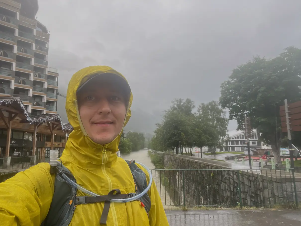
It’s raining and looks like it will pour all day, not too heavy but it’s a miserable day. I leave the hotel before 7am on a banana and protein shake figuring I’ll find something to eat soon enough. I can’t see any mountains through the fog.
I’m doing two stages from the Haute Route guidebook today, the first is a short and boring route to Argentière without much climb so I have it done by 9am without much effort. It rained all the way and my jacket leaked, pooling water in the sleeves and leaving me feeling pretty cold, I’m anxious that in the next few days I’ll be properly cold. I found an outdoor shop in Argentière and bought a replacement Jacket which felt a lot warmer and gave me a little more confidence, I don’t want to know how much I just spent.
Leaving Argentière I passed under a railway bridge with the Mont Blanc Express train passing over it, through the bridge the trail heads uphill into forest trails, my mood lifts and the rain calms down on the way up the hill. I hear birdsong I don’t recognise and some blue sky appears.
My hydration bladder doesn’t seem to be working, I figured it must be squashed in my pack and blew into the tube thinking it might get the shape back and I’d be able to pull water from it again. This was a stupid idea, the pressure pushed water out the top and loads of cold water poured out my bag and over my shorts! This was just before arriving at an amazing view of Glacier du Tour at the village of Le Tour, which I didn’t stop to look at as I was worried I looked like I’d pissed myself. It turned out the tube was just a bit kinked and I’m an idiot.
 The climb from Le Tour to Col de Balme in the distance
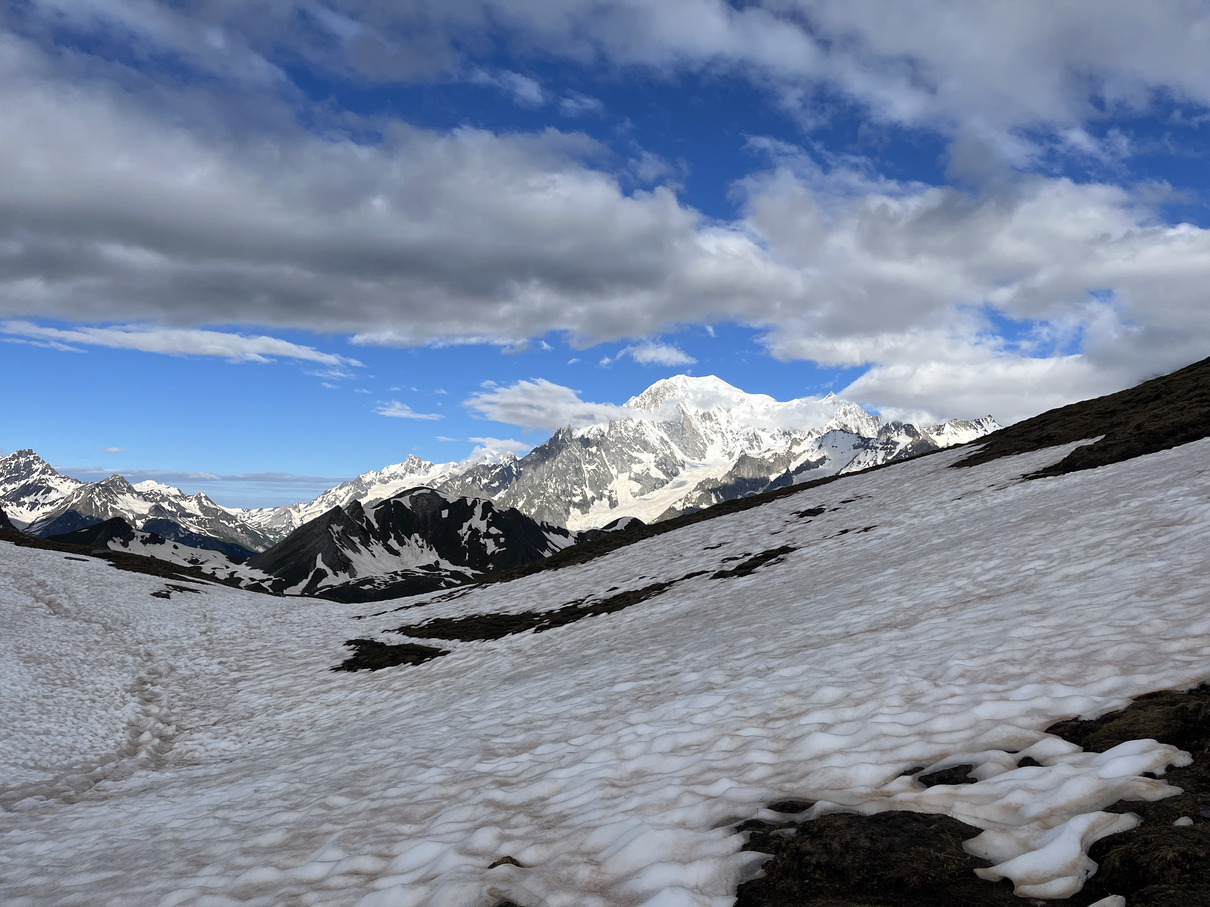
From Le Tour, the big climb of the day takes my up through a ski resort to the Col du Balme on the Swiss border. It’s steep, about 750m climb in a little under 5km but the path pretty easy underfoot and the views are opening up, the sky clearing too. I finally get a glimpse of Mont Blanc peeking out of the clouds before stopping for lunch at Refuge Col de Balme just before midday. Looking back into France there is a storm building, in Switzerland it looks like there is quite a lot of snow, but I can’t tell what the trail is like coming down from the Col, I’m only about 2200m up so I hadn’t expected to see much snow on 21st June! I had courgette soup, Coke and an espresso before running the day’s final descent.
 Looking back to into France
 First and last view of Mont Blanc before crossing into Switzerland
The trail is fine, a few short snow crossings and not too much mud. I start getting a little urgent for a toilet and within minutes a branded “Toilet with a view” appeared, with windows to look at the mountains while you sit! The door opened to the best view, directly down the valley to a vast view of beautiful snowy mountains in the distance.
 Lunch at Col de Balme, 2200m
A few more minutes and I arrived in Le Peuty, where I’m staying, just before a storm broke and the heavy rain came. Good timing. The refuge is a low level on by the road and they have a yurt to eat and drink in where I take shelter from the storm. Basic lager tastes amazing after a day out in the hills.
For dinner I’m put with two others who are doing the Tour of Mont Blanc alone, hiking in opposite directions, so they have plenty to share about what’s coming up. Joanne had come to Europe for a couple of months from Australia and had completed the Wainrights Coast to Coast, the West Highland Way and was now just beginning the Tour of Mont Blanc, she’d hiked a lot in New Zealand and clearly loved these multi-day hikes. Remi was new to hiking and she’s from Singapore, where there are apparently no mountains! She said she took up running last year and mentioned going to Hong Kong for a mountain trail half marathon where she said it all felt very slow, then the was a fast road section where she overtook a lot of people. She came third and didn’t seem to understand that this was any kind of achievement. Remi was squeezing the Tour into 7 days and struggling to keep the pace up and said she was learning a lot, especially after arriving at a col in a storm and taking refuge for the night in a tent with someone she met a few hours before, with no sleeping bag, instead wrapped up in a beach towel because she didn’t know how to pack light! It was great to share stories while eating dinner, then again at breakfast.
 My bed in Refeuge Peuty
Day 2 – Le Peuty to Le Châble (nr Verbier) - 32km - 1166m climb
I said goodbye to Remi and Joanne. The refuge staff said it wasn’t safe to take the high alternative route over Fenetre d’Arpette as there was a lot of snow. I met another group of 4 guys who intended to try the Fenetre d’Arpette route anyway, I had a long day ahead of me so I wasn’t up for trying it against the refuge’s advice as it’d be a long way to backtrack. The climb ascends first to a road about Trient, then a little further to Col de la Forclaz where there is a shop and a hotel, I’d had three coffees in quick succession this morning and a bunch of bananas over the last two days. Just before arriving at Col de la Forclaz, I farted and shit myself, this wasn’t how I’d hoped the day would start. Spotting a toilet block in the car park by the hotel I went in and cleaned up – luckily my boxers were fine. What a relief.
On the gradual climb out of Col de la Forclaz the views went from the pretty to stunning as clouds sat in the valleys and others rose up in the foreground, obscuring the views then revealing them again, sometimes creating a frame of clouds for the views, backed by vast snowfields in the far distance. Passing Bovine mountain refuge the clouds climbed up the valley so the mountains eerily faded in and out of view, clearing again shortly before I met groups of hikers coming the other way, a lot of groups. Friendly bonjours and bon courage exchanged.
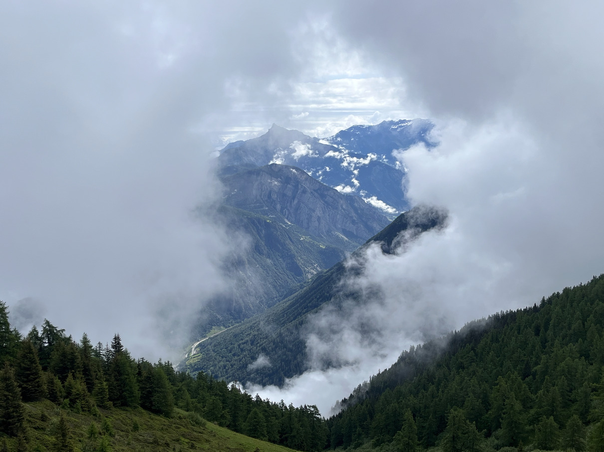 Clouds framing my view of the mountains
My feet were soaked by a couple of rivers crossing the path that couldn’t be avoided then a rocky descent, I tried to run but there were still a lot of hikers getting in the way. I did laugh a little when they tried to keep their feet dry crossing puddles and small streams, knowing they’d be knee deep soon! I got distracted and rolled my left ankle twice on the descent and decided to walk for a bit until the trail got easier, then ran most of the way to Champex, arriving at about 11:45. I had sorbet for lunch and cracked on for Le Châble.
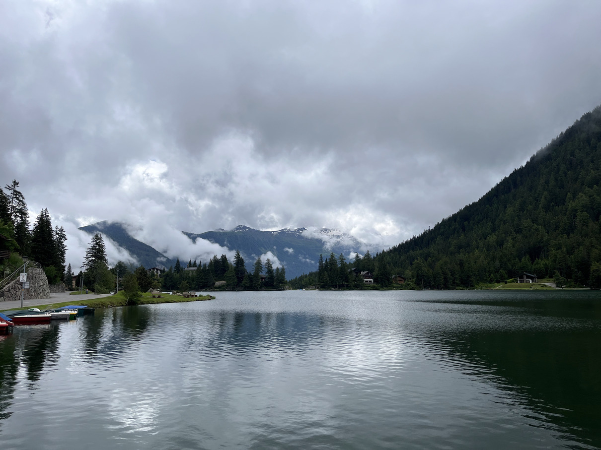 Champex Lac
The trails were easy running for about one and a half hours, mostly downhill to Sembrancher. Leaving the alpine trails and descending on wide tracks and some roads. The clouds were turning a little darker. It now feels like rural Switzerland with flattened fields and working farms between forested mountains, no longer full of groups being guided round the Tour of Mont Blanc, which my route left at Champex. It started raining heavily as I reached a forest track which climbed, though not steeply, eventually to a singletrack trail that dropped down steeply. The rain got heavier and I heard a loud sharp crack of thunder, then again a loud crack. That’s not thunder, it’s a supersonic rifle round. I descended quickly and kept hearing shots getting louder until I reached the river at the valley bottom and they were right over my head. The atmosphere felt very different since I left the Tour of Mont Blanc route. I ran quickly along the track with the river loud beside me, the shots quietened and I emerged onto a road in an unfriendly industrial area with vans and snowplough and industrial buildings everywhere, still heavy rain. I moved as quickly as I could manage and soon I could see Le Châble to the left, I had to remind myself to breathe deeply and began to feel normal again. It’s easy to get worried with days of high mountain hiking alone ahead, my brain was ready to be scared.
I arrived in Le Châble at around 2:30pm, not much seemed to be going on but I found a bar and had a couple of beers and then checked into the B&B at about 4:30ish and had a proper shower. I had a pretty uneventful evening in Le Châble, another beer, a big bowl of pasta and an early night.
Day 3 Le Châble to Cabane de Louvie - 15.1km - 1561m climb
In the morning, another guest was speaking French to the owner of the B&B, I don’t really understand French at all but I could tell he was talking about the weather and it was as if things hadn’t been going to plan. “Vous parlez Angais” I said and he explained that there was too much snow on the higher passes so it could only be done on skis. The Haute Route was not safe to continue on as a trail runner, he was a day or so ahead of me on the same route but had to stop and turn back. He went on the say the Zermatt was unreachable anyway after being totally cut off by extreme weather, causing flooding and landslides. BBC News confirmed this, it didn’t look good, people are missing. He said it was well worth going to the next cabin, although it’s too snowy to take the normal route so I’d have to go along the valley and take one steep climb from Fionnay up to Cabane de Louvie. I had little chance of getting any further. Also there’s no signal at the next cabin so I needed to deal cancel my bookings before leaving.
I emailed the hotels and huts to cancel, and figured I’d be best to rejoin the Tour of Mont Blanc route and do some of that so I searched for a hotel somewhere back toward or on the Tour. I found somewhere in Orsières, near Champex where I’d come from the previous day. That’d be 2 days crammed into one so it’ll either make a long day and I might need to take a bus some of the way.
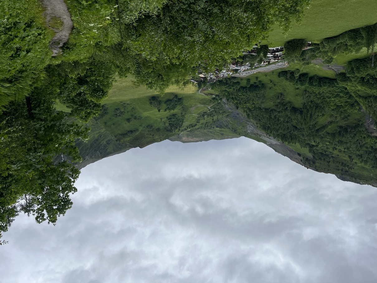
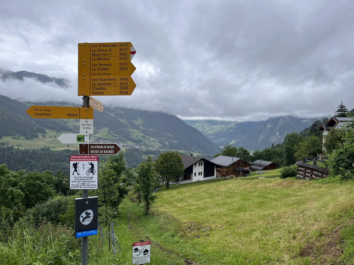 Leaving Le Châble on a miserable day, I guess it is still quite pretty on a grey day.
I finally managed to set off after 10AM into a miserable overcast day. I walked out of Le Châble and climbed a few hundred metres until the town looked small and started texting people who knew I was headed for Zermatt to tell them I was OK, I wasn’t trapped under rubble in Zermatt as it was a few days away. This was quite confronting and I felt a strong mix of emotions. A year ago this month I proposed to Rebecca in Zermatt with the Matterhorn as our backdrop, the Matterhorn is revealed very late on the Haute route and is one of the most striking views imaginable. With or without emotional significance the place is quite special.
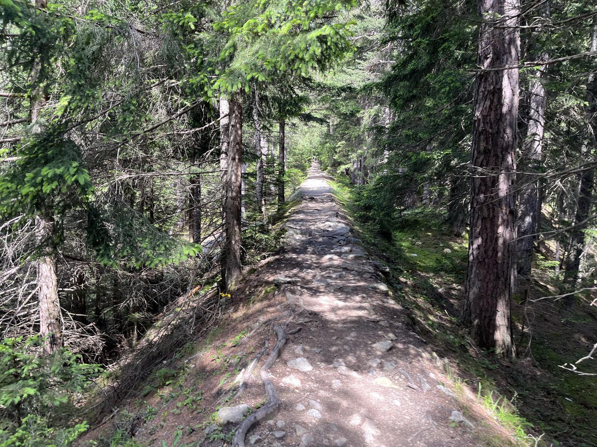
The route wasn’t particularly interesting so I didn’t have a lot to distract me from the unfolding tragedy in and around Zermatt. There were a lot of quiet roads and the weather stayed grey. Eventually I reached two reservoirs, and a signpost to Cabane de Louvie: “+755m, 2hr”. I called Rebecca for a chat as it might be the last time I had signal. I was feeling a bit more positive by now, looking up at the final climb, a mass of rock and pine trees rising right up into the clouds. Before I’d said much I spotted a bird high up flying between the trees on the mountainside, it’s hard to guess scale at that distance but it was soaring with no effort at all, never flapping its wings having mastered the skill of harnessing all the free energy available from moving air. Not being buffeted about by the breeze at all. Surely that’s an eagle. Then a marmot moves and disappears into its hole. I get a few more words out to Rebecca and an Ibex jumps across the path just in front of me!
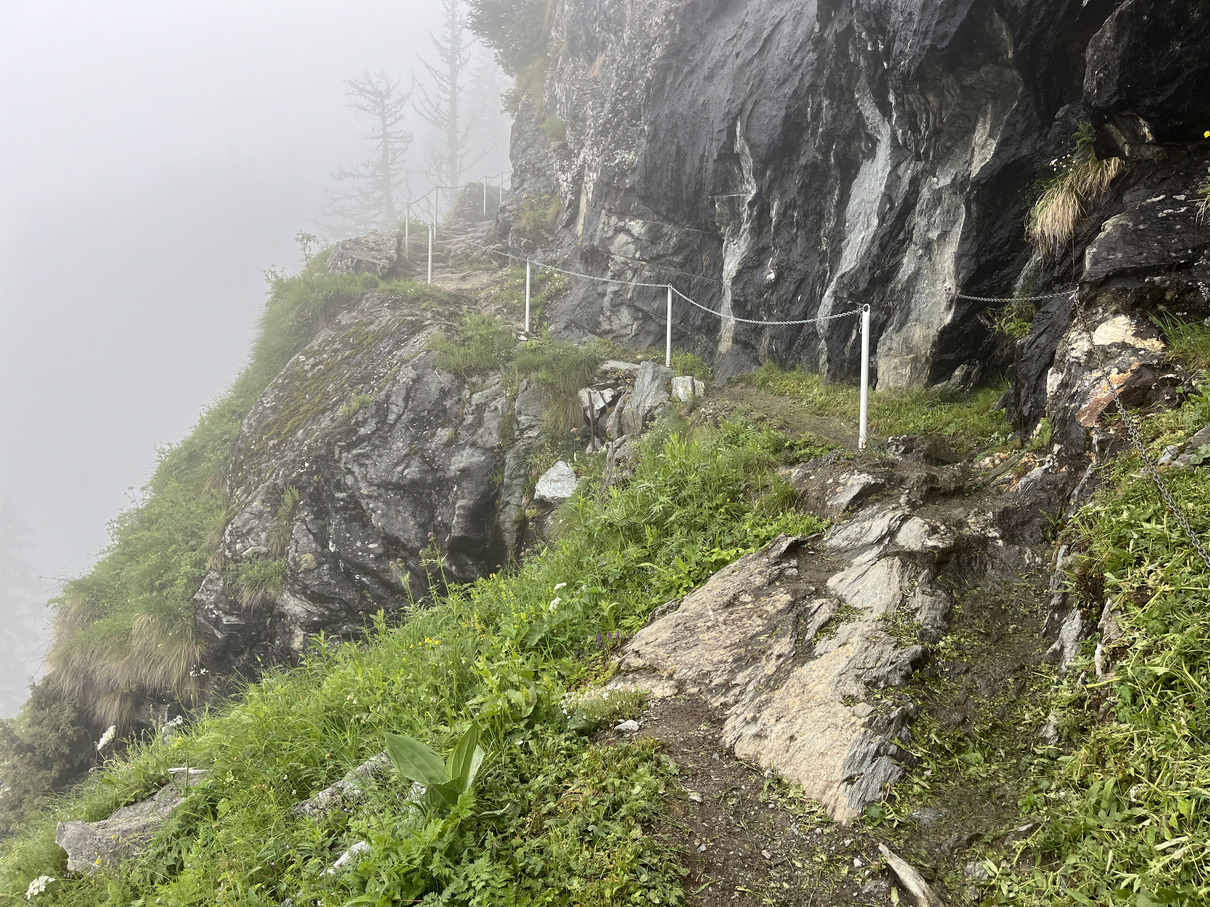 Climbing stairs into the clouds towards Cabane de Louvie
The hike up to Cabane de Louvie was steep all the way but so beautiful, watching the reservoirs shrink as I climb until they disappeared and I’m in the cloud. I passed quite a few more marmots then the path levelled out and I spotted some hoof prints in the path that looked recent, out of the cloud to my left appeared a huge male Ibex. He looked at me briefly and didn’t seems to care that I was there. I got a few pics and he slowly walked off like he thought, “no I’m not posing for you”.
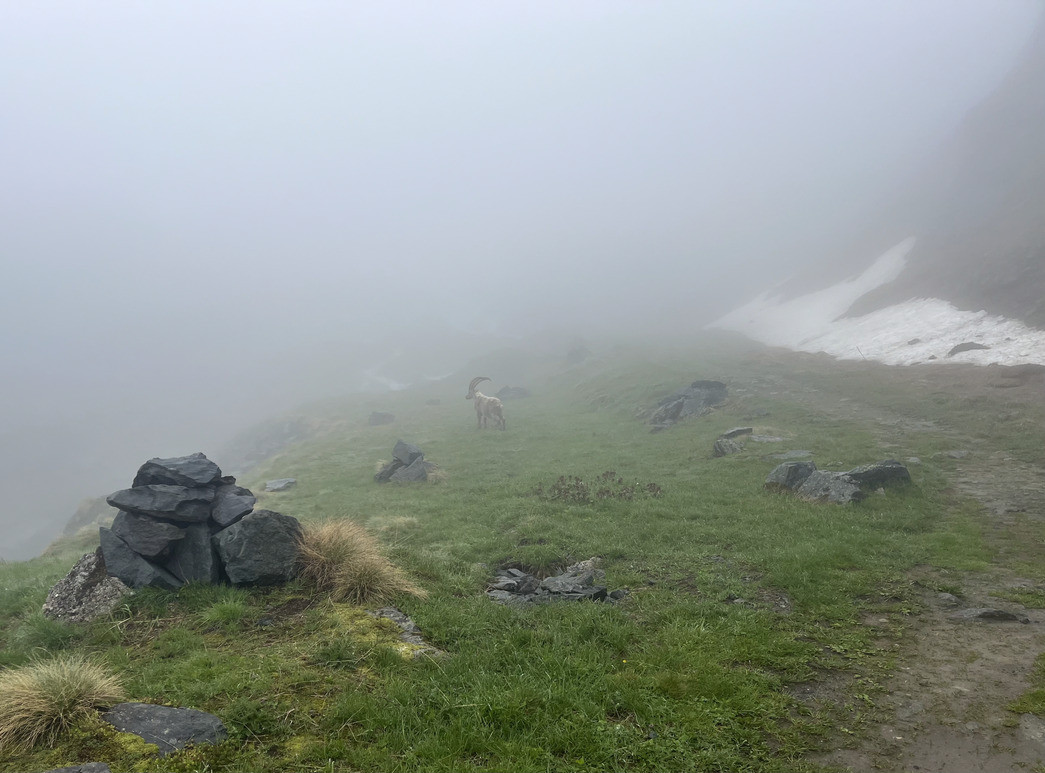 Ibex in the fog
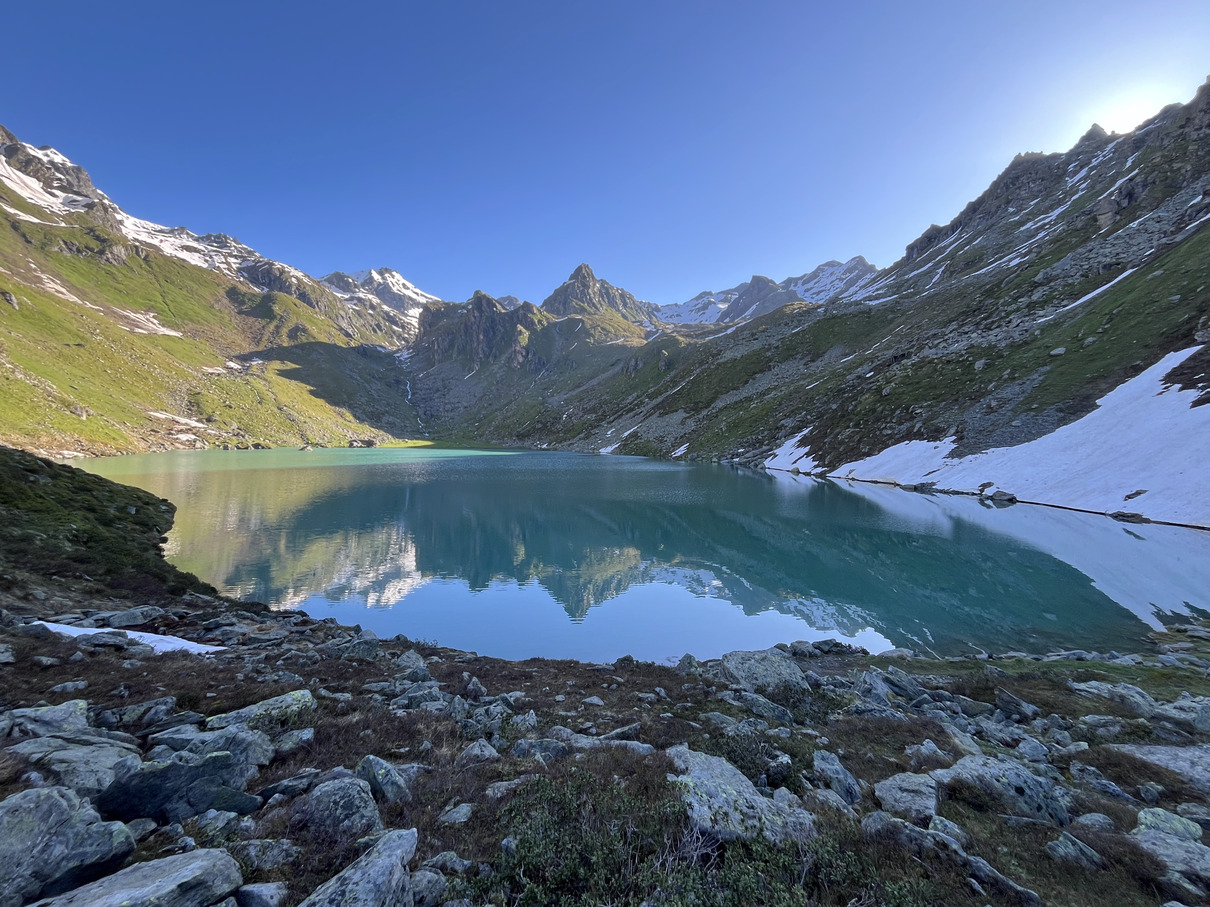
I could hear a river smashing on rocks on my left and see big snow banks on the right of the path, a small building materialised from the fog then a signpost for Cabane de Louvie pointing across a footbridge and a dam ahead upstream with water pouring over. Crossing the footbridge I climbed a little more, and could see the lake behind the dam. It’s that bright but deep greenish blue you only see in mountain lakes, with fog hanging over it for extra atmospherics. Cabane de Louvie finally appeared, it’s a big one, I went straight in as it’s a little chilly up here.
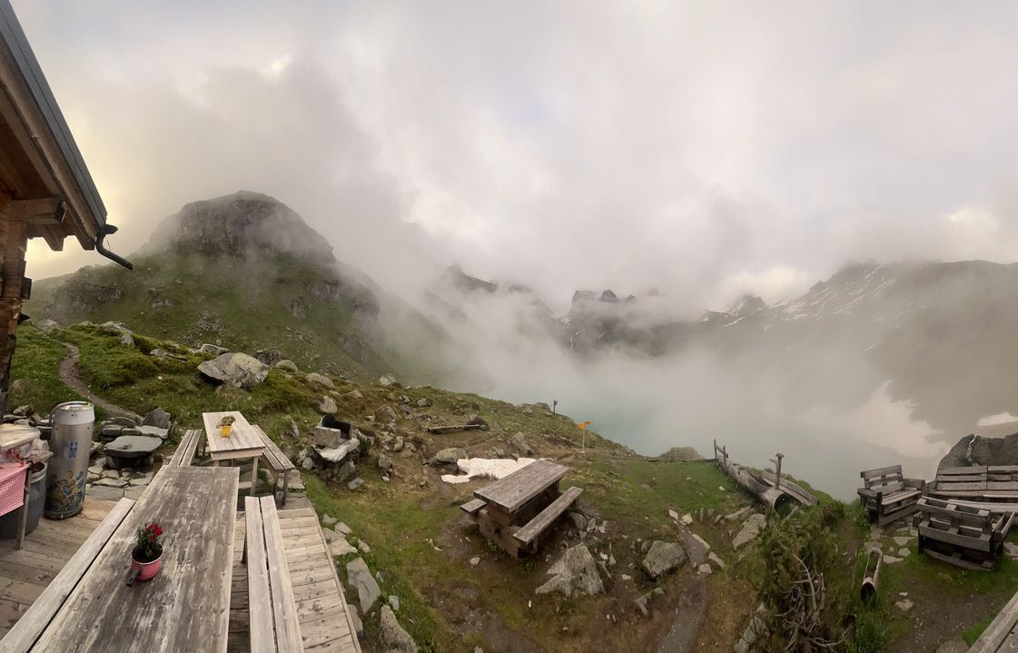 Louvie Lac
I arrived at about 2:30, sat down in the cabin had a coke and then checked in, I was shown my to my bunk and given a token for the shower that would let me get 4 presses of the button, each giving 20 seconds of water. Although this sounds incredibly short it was a surprisingly good system as you’re not left guessing when its about to run out.
After the shower I sat at one of the tables and looked at the map, trying to figure out a route for tomorrow. I could backtrack completely on the last two days or find another way. I could see another way that looked interesting but it would take me up to 2500m again, I asked the guardians of the refuge and they weren’t sure but a table overheard and had a look at my map. They thought there would be too much snow, and my route was far too long for one day! They suggested to stay at a refuge about a third of the way and then there was a a detour around the snow that would make another good day’s walk. They look like hikers though, I think I can get a bit further than they might, but they have given me a little doubt. I think I have a route anyway and I’ve marked the potentially dangerous section on the map.
The refuge slowly clears out and I have a few hours to myself, gradually the evening guests start arriving. There’s an American group of four women, a group of friends and one of their daughter’s I think, there’s a big group with a guide, a couple from Florida and an older French guy on his own. I end up sat with the older French guy, Claude, and the couple from Florida, James and JJ. Well eventually, James and JJ had fallen out a little so only James was at the table when dinner was served as JJ was crying in the dorm. James went back a few times and managed to encourage her out, I think she’d been spooked by the snow enough times in the day and way exhausted and her emotions just needed to pour out. The four of us chatted away for the evening, James and JJ had been in more snow than me and were trying to continue the Haute Route but with detours, public transport and some days of just doing something different where it’s too dangerous. Claude was on another level. Last night he slept alone in the winter room of another refuge that wasn’t open yet because there was no route deemed safe for hikers. James and JJ knew the North American ski scene well, Claude mentioned he had skied in Canada, he struggled to remember the name of where, finally he side “it was called… Roger’s Pass” and theirs jaws hit the floor, they told me that it avalanche zone, it’s a key trade route so there’s a road, but some crazy ski mountaineers use the road to access a vast back country ski area. James was clearly an expert skier and said he had skied relatively near at a resort called “Kicking Horse”, he said he got dropped by helicopter once… Claude misunderstood and replied, almost angrily: “I never took an ‘elicopter…” he’s a purist. I asked how he slept when he ski toured for a week there, he smiled a little and said “igloo, there is no other choice”.
After dinner the fog outside was lifting and most of us went outside. I grabbed a beer and did the same. The clouds were pretty active, some were sitting in the valley below and others rising up. Mountains appearing like islands in a blanked of white ocean, then whole mountains would be engulfed to appear again later. The sun was shining through from the side, landing only on some of the clouds so there were a few bright gold ones. Huge vast snowfields would appear when the view opened and disappear again a minute or two later. We were all in awe watching this free show. As it started to get a little darker two Ibex appeared on top of the nearest peak, a few of us watched them descending, it felt weirdly voyeuristic, almost like we were egging them on to take bigger risks. They’d stand there for a bit and look around, then take a huge drop down the cliff face and stand and have a look again. One time one of them fell and rolled down what looked like sheer cliff, somehow it stopped itself, had a break for a couple of minutes then carried on. I’d rolled my ankle a few times and my mind raced about how I could die if I wasn’t careful, these Ibex could take a huge fall and just carry on!
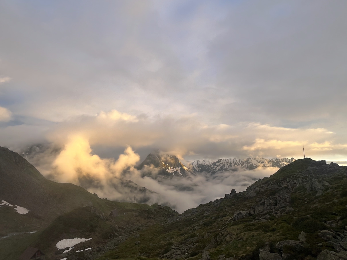 Clouds in the valley by Cabane de Louvie
If you ever get a chance to stay in Cabane de Louvie, stay there, it is beautiful beyond description.
Day 4 Cabane de Louvie to Orsières - 30.9km - 1576m climb
After breakfast I headed off at about 8 am, very different views from yesterday, not a cloud in the sky. The lake outside the refuge was a mirror, flipping the mountains over. I set off down the same trail I came up, overtaking James and JJ we shared “good lucks” and made some silly jokes together, waving as I tried to keep a decent pace down the steep and rough trail. I could see the reservoirs looking tiny in the valley and way off in the distance a huge dam that looks like the one in Goldeneye. The morning felt much better already than yesterday. Although I only have accommodation for tonight booked I’ll be much closer to places where I can take public transport or find hotels. It’ll be OK even if it’s not to plan.
 Lac Louvie reflecting the mountains in the morning
At the valley bottom I caught up with Claude, I didn’t think he left long before me and I’ve run down the hill. James asked his age last night, he’s 73. I’ll be proud ever to be as tough as he is, let alone at 73.
I stopped at the valley bottom in Fionnay where I had a good signal to get the route planned into my phone and watch, seeing as I have a long day it’ll be much easier than carefully map reading all the way. I planned the route that avoids the high point at Col de Mille, but hopefully I’ll be fine to climb over there as it’ll be slightly shorter and it’s always dramatic to see a view open up over a col. I ran a flattish mile or so then I’m at the other side of the valley and it’s straight back up. It was a relentless climb of 800m in 3.5km, either steep or ridiculously steep, through pine forests at first rising into more open mountain, it took about 1h45m to climb and it was hard but it was breathtakingly beautiful the whole way. Confusingly I could smell freshly cut grass for the entire climb, the whole way up it had been neatly strimmed, either in the morning or maybe the previous day. I didn’t see anyone else during the climb, who the hell is strimming such a steep and quiet path?
 Almost at the top of the today’s big climb
It’s been a hot and sticky start to the day but eventually the trail levels out a little, there must be an easier way up as it’s quite busy all of a sudden. There’s a refuge ahead, Cabane Brunet, this is where the guys last night said I should stay, that would have been a short day, it’s 11:45. I stop for some lunch at the refuge and then set off running as the trails are flat or rolling now instead of steep. There are still amazing views, now into the valley that I’m running along the top of. The paths quieten down as I get further from the refuge which is a relief, I pass a tiny clear lake which is about a foot deep and full of fish, at about 2000m!
 Nice runnable trails
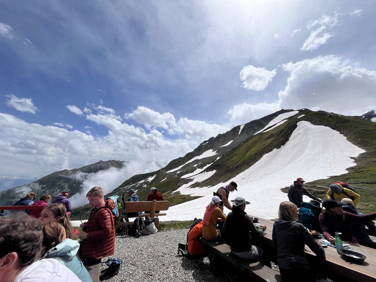
The trail continues to be runnable and pretty for an hour or so and then begins to climb up toward Col de Mille, there’s a few pretty steep snowbanks to cross but they’re not dangerous, where I can avoid them I do though as it’s best to avoid the snow in running shoes. Ascending towards the Col there’s a little more snow and finally at Col de Mille I need to put on the spikes, it feels a bit dodgy climbing this last bit of snow but I wouldn’t slide too far if I slip. On top of the col the views are again incredible, there’s another Refuge and it’s time for a coffee.
 View from Mont Brûlé, 2560m
There’s a little more climb out of the refuge, including a viewpoint at Mont Brûlé at 2560m then the rest of the day is downhill. I arrived at Orsières at 1730 and checked in to the Hotel Terminus, they made a cockup with the key, telling me the dorm was unlocked but they didn’t have a key for me. The room was 3 floors up and it was locked. There was no one at reception when I went back down and a sign read “ask at the restaurant if there’s no one here”. I asked at the restaurant and they were pretty rude, just wanting me to get out of their way and sending me back to reception. I waited quite a while and went back to the restaurant and asked for them to find someone. It was a shit and unfriendly hotel that clearly didn’t want to deal with having hikers in their dorm rooms. There wasn’t much choice of restaurants in town so I checked their menu, about £25 for a veggie burger, fuck that. I was about to get the train to the next town but spotted a cafe bar place doing pizza. The menu advertised courgette but the pizza came out with cucumber on. I don’t think I’ll visit Orsières again.
I looked for somewhere to stay the for the next evening and found Rifugio Bonatti seemed to have space so I put in a booking request. They emailed back pretty quick to confirm, saying I’d need to pay cash. I confirmed and then remembered I only had Swiss Francs and Bonatti is in Italy.
There was one person who was helpful and friendly at the hotel, I asked her how I could change Francs for Euros, she said the bank was likely the only option and it doesn’t open until 9am. There were no big towns on my way to Bonatti and it is just across the Italian border so even if I found a cashpoint it would give me more Francs. I guess it’ll be a late start to a 20+mile day, not ideal.
Day 5 Orsières to Rifugio Bonatti - 34.2 km - 2233m
I had breakfast at the hotel and chatted to Emily, a trail runner from Oregon who’d come out with a run tour group to run half of the Tour of Mont Blanc, although her flight was delayed so she’s not joined the group yet. She was gutted to have missed to trails from Italy across the Swiss border and would be taking the bus a few miles to join the group this morning. She was good company and I didn’t feel too stressed with the late start with someone to chat to, she was taking it easy as she had to wait for the bus and I had to wait for the bank to open.
I went into the bank at 9 and asked about Euros, I needed to have an account and they couldn’t help me, shit! Then they said I should just go to the post office, which was only a minute away back by the hotel. The post office changed my Francs to Euros and I set off, it had opened over an hour before, which was annoying as I could have set off much earlier!
 Easy but less exciting trails to start Day 5
The run is not particularly exciting to start with, I tried to keep a decent pace, a couple of hours in there were big groups coming the other way. I saw Emily coming the other way with her group, she looked very happy to finally be on the trails. This section is nice, but in comparison to other trails nearby it feels pretty boring. I got to La Fouly at midday and stopped for something to eat. I had a full stage of the Tour of Mont Blanc to go and still a lot of climb.
I get a couple of kilometres to let my food go down, then it’s the climb up to Grand Col Ferret, it’s steep and relentless. The crowds are gone and it feels a little lonely. The clouds are closing in again and it feels like a storm could come in, I don’t really want to be on the col in a storm, it’ll be snowy and could get dangerous. It’s a long slow climb up to the refuge Alpage de la Peule, which is close-ish to the col and it’s getting cold there, I filled up with water and tried to keep moving, the gradient isn’t so bad and there are a few more people coming from the other side. It feels a little safer in the snow when there are others around, and the snow patches are getting a little bigger now. The temperature drops rapidly toward the col, and the visibility. The snow goes from patches to complete ground cover, I put micospikes over my shoes to get a bit more traction and try to keep moving quickly.
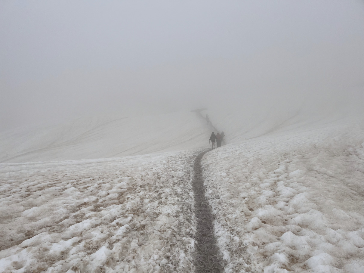 Snow just before Grand Col Ferret
Eventually I get to the col, it’s a little sketchy on the last stretch with snow at steeper angles and I can’t tell how far I’d fall if I slipped because there’s very low visibility now. There’s nothing to see at the top, just a few trail markers and a trig point thing with “Italy” on one side and “Suisse” on the other. It’s fucking cold now and I don’t want to hang around but it’s hard to see which way to go. It seems the main trail is traversing along the hillside in the snow, if you slip you’re going to have a shit day. I pulled out my phone to check and it seemed to agree, so I headed that way. It didn’t feel safe up here in the wind, cold and fog on a steep snowy traverse! Some hikers came the other way and confirmed I am headed on the main trail toward Rifugio Elena on the TMB route. Soon enough the nasty traverse was done and there was a more fun downhill but manageable soft snow section where I pretty much skied down, running and sliding and trying to stay upright. Then the trail got steep and muddy and it was hard to even walk down and stay on my feet.
A few people asked me what the snow was like going over the col and I think I still sounded scared as they looked a bit uncomfortable when I said it wasn’t great. One American guy asked if he could buy my microspikes for his traverse but I had no idea when I’d need them again. It was hard packed snow, probably fine really but a little scary.
After the steep downhill to Rifugio Elena, the rest of the way wasn’t so bad, just one snow crossing stood out, over a stream I knew it was a snow bridge but it seemed OK-ish, when I crossed it and looked back I realised it was very thin and I should have found another way. I made it to Rifugio Bonatti for about 5:30, checked in, had a 1-minute shower where I didn’t even manage to get the soap washed off before the shower cut out. I had to wash my armpits off by splashing with freezing cold water from the sinks next to the showers! Then I sat outside and had a beer with a view of the eastern flank of the Mont Blanc Massif, with Grandes Jorasses right there poking the sky.
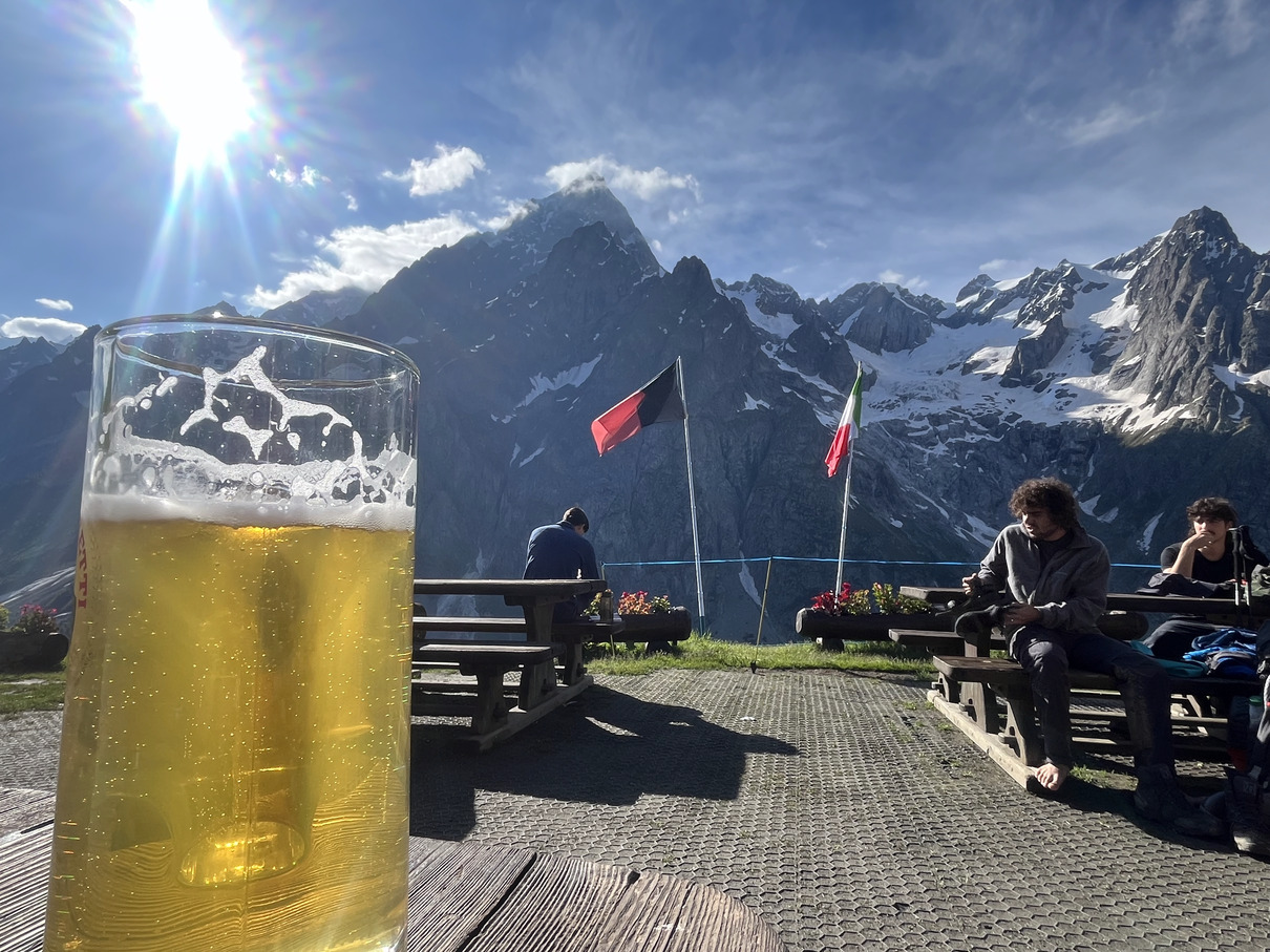 At Rifugio Bonatti
I chatted to a few people and relaxed until dinner. I tried to figure out an interesting route for the next day. It looked possible to get to Grand Col Saint Bernard, but I couldn’t be sure I’d make it in the day or that the passes would be safe, the only thing I could be sure of was getting down to Courmayeur, it’d be easy enough to get wherever from there so I booked a the cheapest hotel there.
Bonatti has a very communal feeling dinner, about 80 people all eat together, they’re almost all doing the Tour of Mont Blanc so they all have something in common. The vegan option was OK, not very creative but it was food and it filled a hole, it’s a surprise how easy it is to find vegan food in remote places sometimes. I chatted to one of the guardians after dinner as they would know the snow conditions and they helped me find a route that seemed interesting, heading for Col Sapin with a few options of different routes down to Courmayeur, it’d take me off the main route and I’d be on the snow again but as there were options to just turn back or head down after the first col before, or carry on over Col Sapin and then descend to Courmayeur.
Soon enough it was time for bed and I climbed up to my bunk.
Day 6 Rifugio Bonatti to Courmayeur (+ Maison Vieille) - 29.25km - 1632m climb
I got up early for breakfast, put on my wet running gear that I rinsed in cold water and ringed out by hand last night, it’s quick drying so it’s not miserable for long. A quick breakfast of bread and jam with coffee and I set off away from the main route, very quickly it was quiet. It’s kind of nice to be on the busy trails as they’re very friendly but it’s always great to leave them behind too for some quiet. My route out was up hill up the Malatrà Valley with markers for Tor de Geants, which goes over Col Malatrà (2925m), that would definitely not be passable as there’s snow well below. I passed a couple of tents just out of view from the refuge. Then the climb started properly toward the end of the Malatrà Valley, I stayed on a much steeper part of the slope to avoid snow, it was a slog and I moved very slow feeling pretty tired.
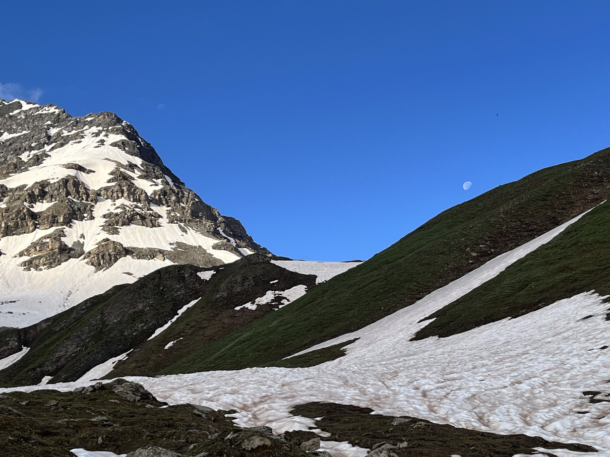 Moonset from Malatrà Valley
Eventually it levelled out and then I couldn’t avoid the snow, it was crusty snow that was soft underneath so it still very slow going – safe enough though as it’s not so deep. I really feel tired.
 Initial view from Col Entre Deux Sauts after a hard climb
Coming over the col (Col Entre Deux Sauts) at 2524m, as usual the view opened up to something amazing, half the view no longer blocked by hillside and Mont Blanc rising out of the middle of valley, fluffy clouds sitting in the sky, blankets of snow on the ground. The sides of the next valley all looked steep and high so I decided not to bother with Col Sapin and headed down to the TMB route from the first valley (Comba d’Arminaz), a nice balcony route to Rifugio Bertone where I stopped for a coffee at about 11am. It was empty when I arrived but quickly filled up as a couple of groups of Americans arrived. When I left, cattle were being moved across the path and a farm dog was running back and forth not helping at all but being very excited.
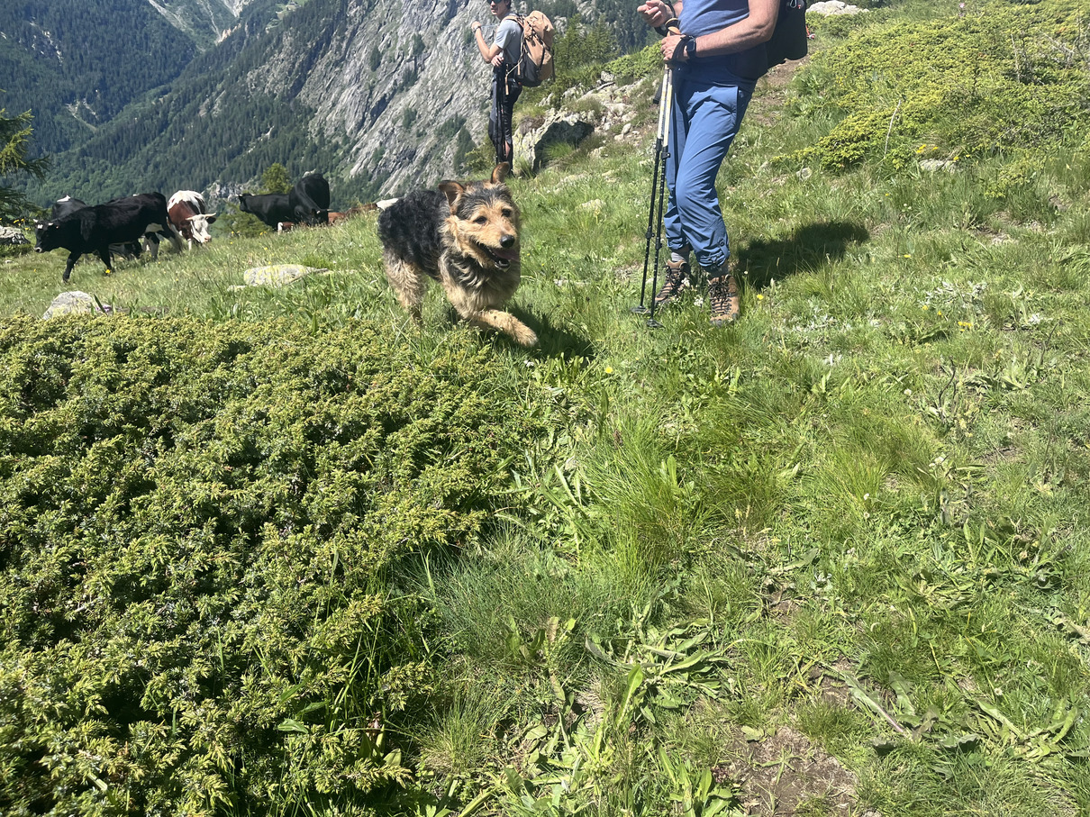 Helpful dog
The cows are pretty docile out here, not scary. Finally it’s the descent into Courmayeur, it’s busy with people climbing slowly and looking exhausted, it’s steep. I try to keep a decent pace down and I get to Courmayeur at 12:30 and go straight for a pizza and a beer at my favourite restaurant in the world, La Remisa. The pizza is incredible and the couple that run it can’t speak a word of English but they communicate with me using flamboyant gestures, mimes and pointing, with so much personality. It’s not actually customary to give tips in Italy but I always leave a tip here.
After my pizza I had a few hours before I could check in and thought it would be nice to see Rifugio Maison Vieille so I hiked up one last hill, almost 1000m climb up a nice bit of trail. Well, people coming down with packs on weren’t enjoying it! It’s a rough steep descent to come down with a big hiking pack on. I had a coffee at Maison Vieille and figured I might as well try to climb Mont Chetif, but after 15 minutes the weather changed and it seemed like a storm was coming, so I decided to race down as quick as possible, taking the road through the ski resort instead of the rough trail. It was an exhilarating final descent.
 The climb after lunch to Maison Vieille
I checked in to the hotel, there were 3 others checking in chatting together, 2 women and a man. One was wearing sandals and had painted toenails, her feet looked very nice for a hiker and I made a silly comment about it. I went to my room, rinsed all my clothes and hung them around to dry, they didn’t smell good, had a rest and went out for another pizza of course. When I was nearly finished I saw the sandals and painted toenails walking past! She spotted me and said that they saw I was staying on my own, did I want to join the three of them for a drink. We had a couple of drinks at a bar in town and we all got along like old friends, taking the piss out of each other and sharing stories. I had a great last night with David (Haarvad) from Norway, Tereza and Veronika from Czechia.
Day 7 A run in Chamonix - 11.6km - 978m climb
I had breakfast with David, Tereza and Veronika. We’d been laughing about the “very good breakfast” being highlighted on booking.com, it set high expectiations. Veronika was a little worried about someone from a group they’d met over the last few days. One of the group had slipped back and not caught up, we wondered if he’d got pissed off with the walk and just got a bus out of there. They wondered where to camp tonight and I suggested where I’d seen the campers above Rifugio Bonatti the previous morning and sent a map screenshot over in case they wanted to camp there.
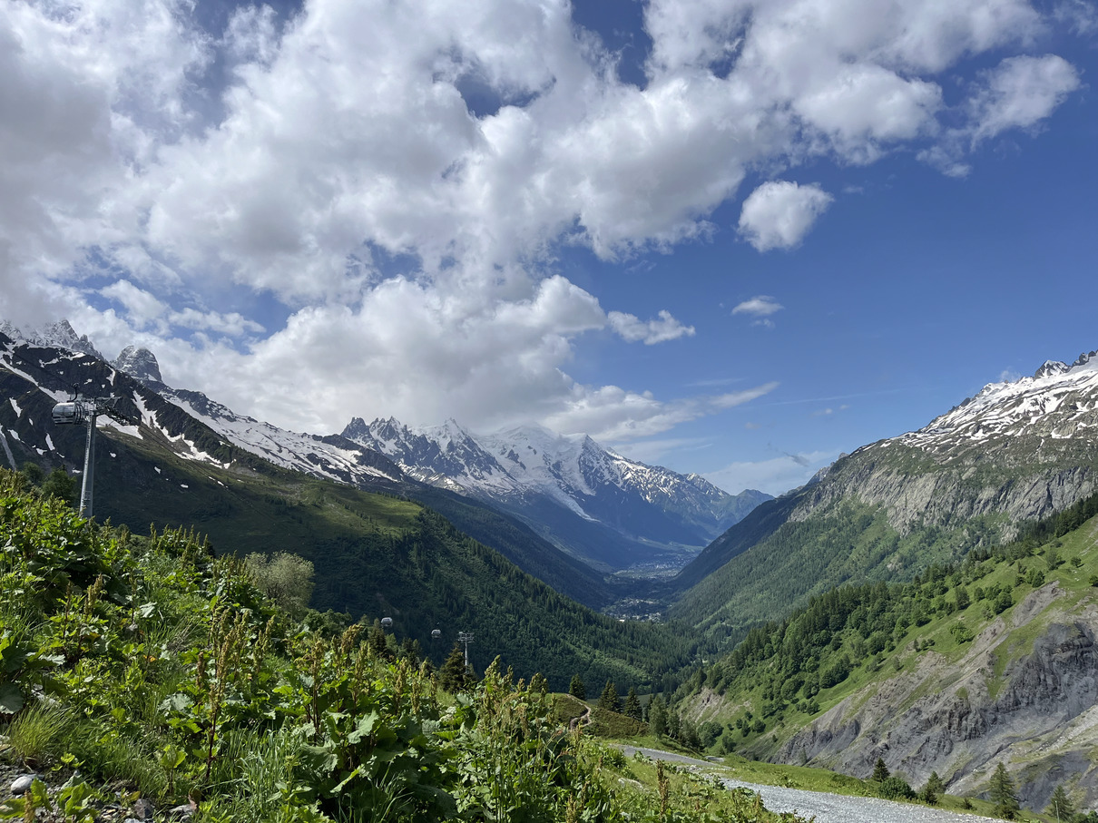
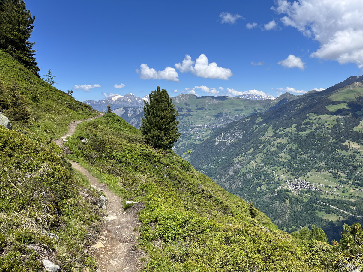
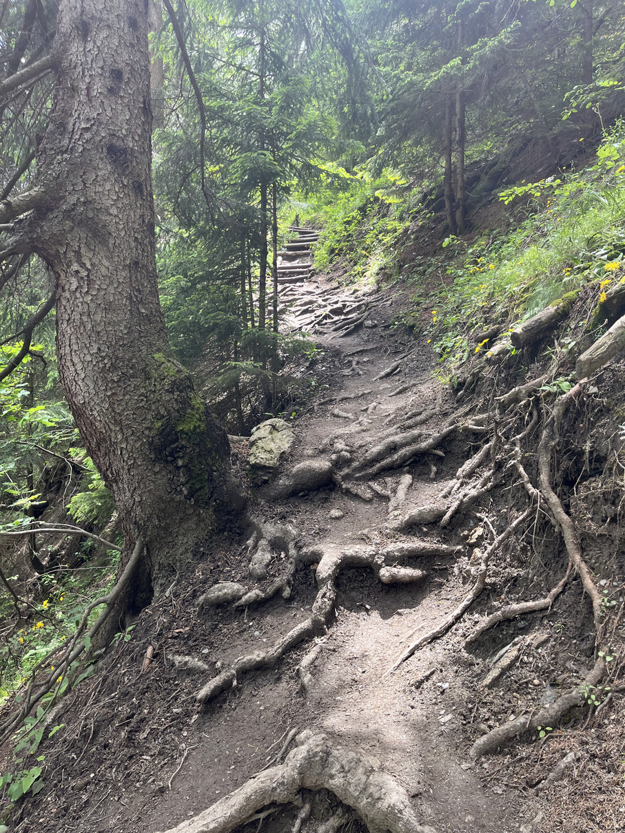
We all said goodbye and I headed to the bus station find a bus through the Mont Blanc tunnel to Chamonix. I had a beer in Chamonix and the went for a wander up the hill toward Planpraz cable car station. I wasn’t sure how far up I’d get and figured I’d probably take the cable car down if I made it there. The climb was steep and it was hot, I felt like shit after a week on my legs but I didn’t need to be fast so just took it easy and kept moving slowly uphill. I made it to Planpraz after 2h15m and had some expensive juice at the cafe up there. I went to buy a ticket for the cable car and decided I’d rather jog down than spend €20 on a ticket so I set off heading down, I felt a lot better heading downhill. I caught up with a grey haired woman half way down and assumed I’d be past in no time, but I struggled to keep up, she must’ve been near 70 years old, I wonder if this is her daily run? It was a really tricky, steep and tree-rooty but of trail so a badly placed foot and you’d go down hard.
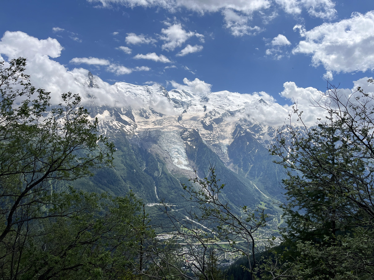 A final day out in Chamonix
I got back to Chamonix and found an Indian restaurant and ate a lot. They warned me about the sparrows, this seemed like an odd warning but they kept jumping onto my table and tying to eat my food! To my right was a fashionable couple who didn’t like the sparrows, on my left was a chilled out Muslim couple who really enjoyed the sparrows and shared their food with them, laughing at the silliness of the situations and smiling at me when they saw me laughing with them. I like them.
I headed to Chamonix bus station and got a bus to the airport. Veronika text saying she’d heard that the guy she was worried about had actually died on the trail. What a painful end to my trip. I never knew this person but it felt very close, especially after the weather event in Zermatt that turned my trip around and where people were still missing.